
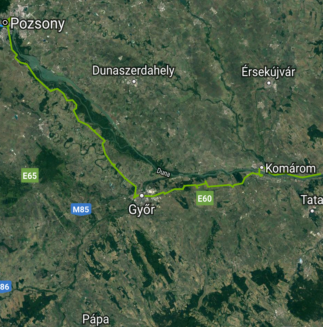
Magyarország [Hungary] (Days 274-308)
- Second Intermission
- Közép-Magyarország [Central Hungary] (Days 281-308)
- Közép-Dunántúl [Central Transdanubia] (Days 274-282)

Green line: approximate route walked.
[Picture credits: Google Maps and Map Marker app]
Slovensko [Slovakia] (Days 266-274)
- Nitriansky kraj [Nitra Region] (Days 266-274)

Green line: approximate route walked.
[Picture credits: Google Maps and Map Marker app]
Magyarország [Hungary] (Days 251-266)
- Közép-Dunántúl [Central Transdanubia] (262-266)
- Nyugat-Dunántúl [Western Transdanubia] (251-262)
Green line: approximate route walked.
Blue line: approximate route by boat.
[Picture credits: Google Maps and Map Marker app]
Slovensko [Slovakia] (Days 243-251)
- Bratislavský kraj [Bratislava Region] (243-251)
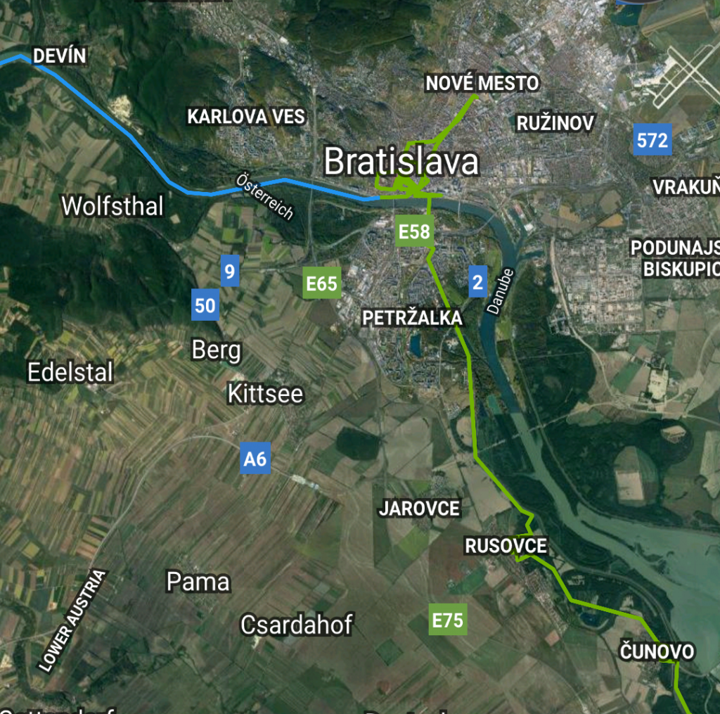
Green line: approximate route walked.
Blue line: approximate route by boat.
[Picture credits: Google Maps and Map Marker app]
Österreich [Austria] (Days 206-243)
- Niederösterreich [Lower Austria] (243)
- Wien [Vienna] (240-243)
- Niederösterreich [Lower Austria] (216-240)
- Oberösterreich [Upper Austria] (212-216)
- Intermission
- Oberösterreich [Upper Austria] (206-211)
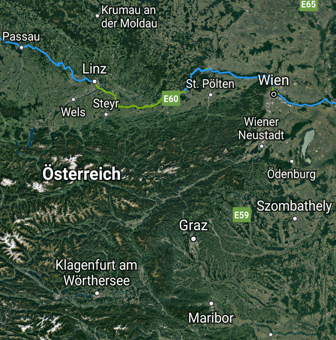
Green lines: approximate routes walked.
Blue lines: approximate routes by boat.
[Picture credits: Google Maps and Map Marker app]
Deutschland [Germany] (Days 74-206)
- Bayern [Bavaria] (147-206)
- Baden-Württemberg (130-147)
- Bayern [Bavaria] (118-130)
- Hessen [Hesse] (114-118)
- Rheinland-Pfalz [Rhineland-Palatinate] (95-114)
- Nordrhein-Westfalen [North Rhine-Westphalia] (74-95)
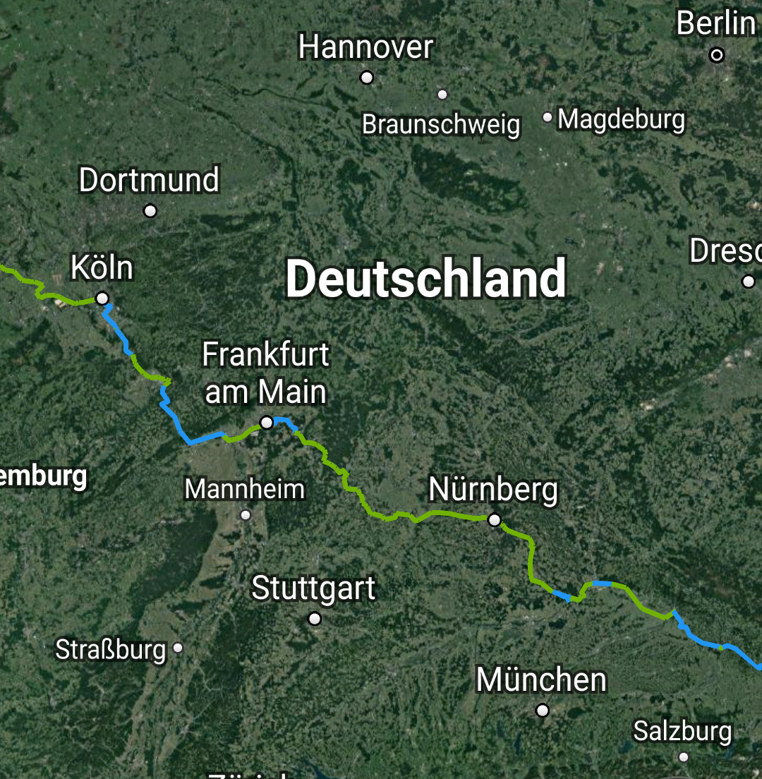
Green lines: approximate routes walked.
Blue lines: approximate routes by boat.
[Picture credits: Google Maps and Map Marker app]
Nederland [Netherlands] (Days 50-74)
- Limburg (68-74)
- Noord-Brabant [North Brabant] (57-68)
- Zuid-Holland [South Holland] (50-57)
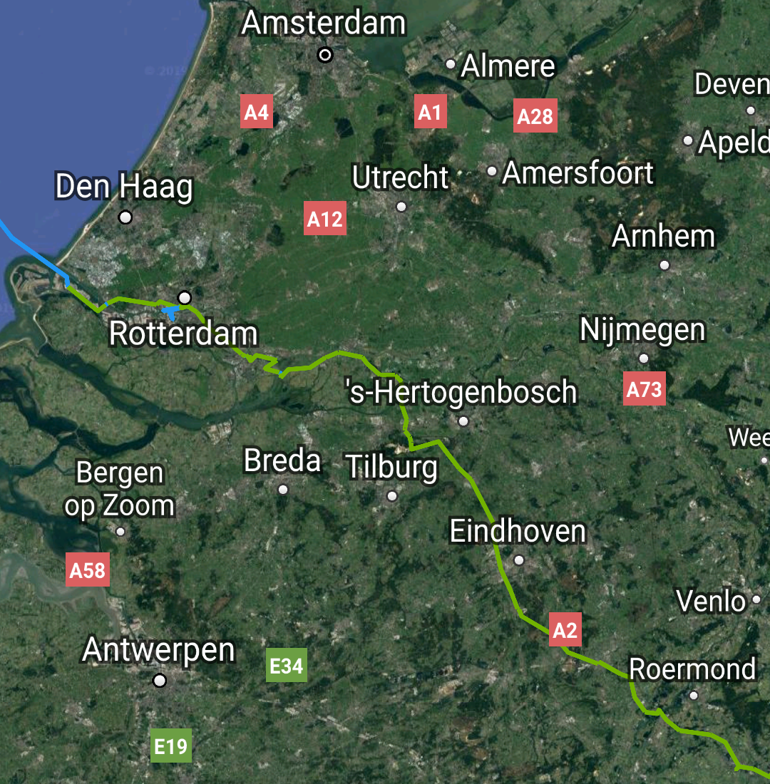
Green lines: approximate routes walked.
Blue lines: approximate routes by boat.
[Picture credits: Google Maps and Map Marker app]
United Kingdom (Days 1-49)
- East Riding of Yorkshire (42-49)
- North Yorkshire (25-42)
- Tees Valley (23-27)
- County Durham (13-25)
- Tyne and Wear (9-13)
- Northumberland (1-9)
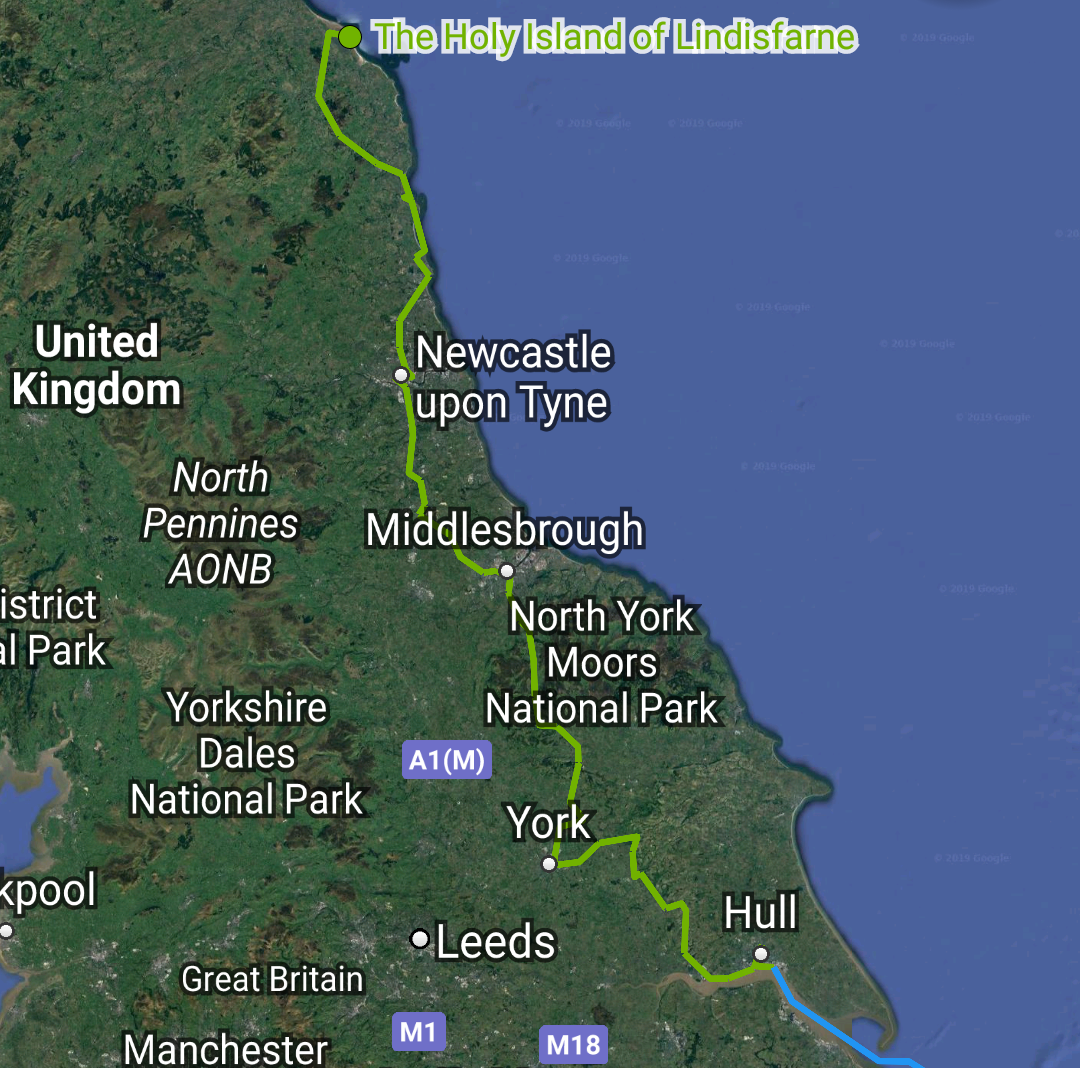
Green line: approximate route walked.
Blue line: approximate route by ferry.
[Picture credits: Google Maps and Map Marker app]